Trail Mountain bike La Tour-en-Maurienne - Le châtel-Le Chaussy-Le Melezet - Photo

Le châtel-Le Chaussy-Le Melezet

 FERAUD
FERAUD

User

© OpenStreetMap contributors
Length
Length
22 km
Max alt
Max alt
1631 m
Uphill gradient
Uphill gradient
1079 m
Km-Effort
Km-Effort  
36 km
Min alt
Min alt
716 m
Downhill gradient
Downhill gradient
1085 m
Boucle
Boucle
Yes
Creation date :
2014-12-10 00:00:00.0
Updated on :
2014-12-10 00:00:00.0

(3 Reviews)

Mountain bike
Mountain bike
2h17
Difficulty : Medium

Scan this QR Code to open this trail in the SityTrail application

FREE GPS app for hiking

Logo SityTrail SityTrail

IGN / Geographical institutes

Download SityTrail from the App Store Download SityTrail from Google Play

Logo SityTrail SityTrail World

The world is yours!

Download SityTrail from the App Store Download SityTrail from Google Play Download SityTrail on Huawei AppGallery

About

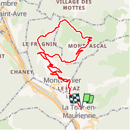
Trail Mountain bike of 22 km to be discovered at Auvergne-Rhône-Alpes, Savoy, La Tour-en-Maurienne. This trail is proposed by FERAUD.

Elevation profile

Photos

Positioning

Country:
France
Region :
Auvergne-Rhône-Alpes
Department/Province :
Savoy
Municipality :
La Tour-en-Maurienne
Location:
Unknown
Start:(UTM)
292815 ; 5020432 (32T) N.

Comments

Please log in to post a review or rate the element


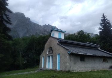
superbe descente sur Montvernier


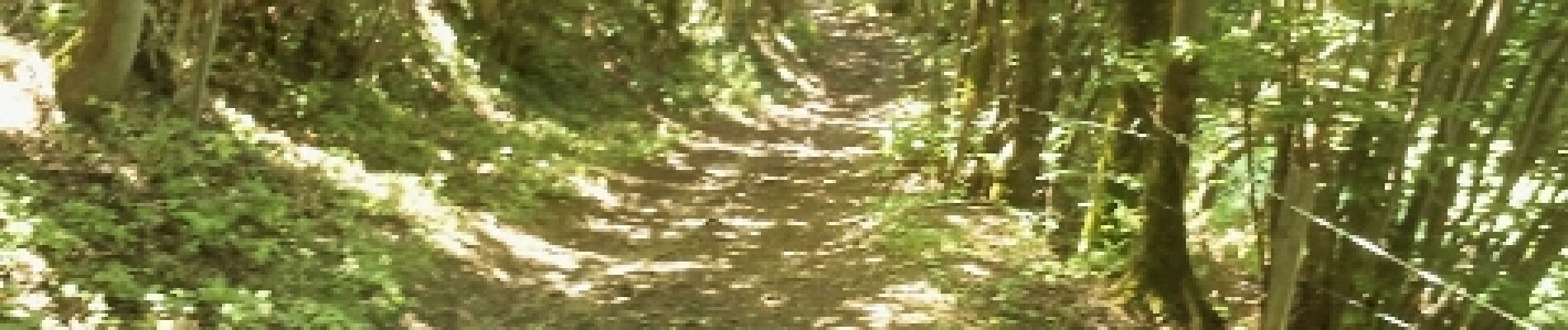
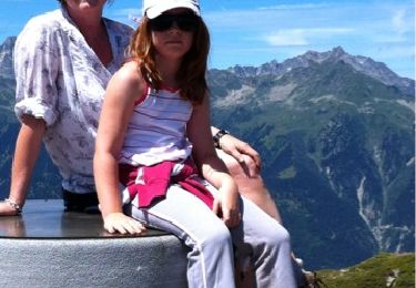
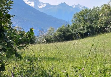
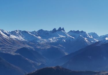
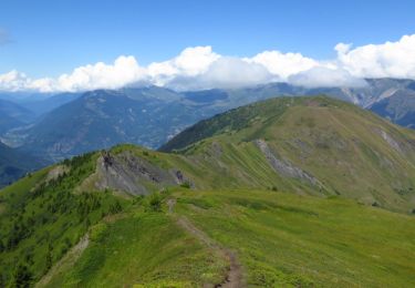
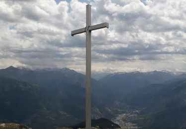
belle randonnée, montée facile sur le bitume et descente par des pistes forestières un peu pierreuses et défoncées par les 4x4 et des chemins plus agréables. De magnifiques points de vue vers l'étendard et les aiguilles d'Arves.


Trails nearby

Trail Walking Jarrier - le grand Chatelard - Photo
Walking
Gorki

Walking

Very easy
(4)
Jarrier, Auvergne-Rhône-Alpes, Savoy, France
4.5 km | 10.5 km-effort
2h 31min
No
Trail Walking La Tour-en-Maurienne - Le Châtel : sentier botanique des Plagnes - Photo
Walking
FERAUD

Walking

Very easy
La Tour-en-Maurienne, Auvergne-Rhône-Alpes, Savoy, France
4.7 km | 8.3 km-effort
2h 0min
No
Trail Walking Saint-Julien-Mont-Denis - crête de Lancheton - Photo
Walking
mapetite

Walking

Medium
Saint-Julien-Mont-Denis, Auvergne-Rhône-Alpes, Savoy, France
11.5 km | 22 km-effort
4h 25min
Yes
Trail Walking La Tour-en-Maurienne - Le Golet - Montandre- chapelle de Grenis - Photo
Walking
GEGERANDO17

Walking

Medium
La Tour-en-Maurienne, Auvergne-Rhône-Alpes, Savoy, France
6.2 km | 12 km-effort
1h 53min
Yes
Trail Walking Jarrier - Leard - Cressua - Cochemin - Leard - Photo
Walking
laurentnecca

Walking

Medium
Jarrier, Auvergne-Rhône-Alpes, Savoy, France
9.3 km | 18.2 km-effort
3h 56min
Yes
Trail Trail Saint-Jean-de-Maurienne - Saint jean de Maurienne - Le Grand Chatelard - Photo
Trail
PatriceTonic

Trail

Saint-Jean-de-Maurienne, Auvergne-Rhône-Alpes, Savoy, France
16.2 km | 36 km-effort
6h 2min
No
Trail Walking Jarrier - Cret Massuet- Col de Cressua - Photo
Walking
Gouze13

Walking

Easy
Jarrier, Auvergne-Rhône-Alpes, Savoy, France
9.7 km | 19.6 km-effort
3h 0min
Yes
Trail Road bike Saint-Jean-de-Maurienne - Chaburtan - Photo
Road bike
nadd73

Road bike

Medium
Saint-Jean-de-Maurienne, Auvergne-Rhône-Alpes, Savoy, France
47 km | 64 km-effort
5h 43min
Yes
Trail Walking Jarrier - le chatelard - Photo
Walking
GEGERANDO17

Walking

Very difficult
Jarrier, Auvergne-Rhône-Alpes, Savoy, France
14.2 km | 29 km-effort
5h 41min
Yes


Close
My subscriptions